| CPC E21B 47/024 (2013.01) [E21B 7/046 (2013.01); G01B 3/12 (2013.01); G01S 19/13 (2013.01); G01S 19/49 (2013.01)] | 39 Claims |
|
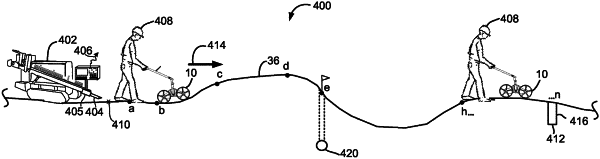
18. A planning tool as part of a system for horizontal directional drilling in which a drill rig advances a boring tool through the ground using a drill string that extends from the drill rig to the boring tool, said planning tool comprising:
one or more wheels for rolling on a surface of the ground along a path responsive to movement by an operator;
an encoder for generating an encoder output responsive to the rolling of one of the one or more wheels;
an accelerometer including at least one measurement axis for generating an accelerometer output during said rolling of the one or more wheels that characterizes a pitch orientation of the planning tool; and
a processor for generating an underground plan for the boring tool below the surface of the ground in relation to said path based on the encoder output and the accelerometer output.
|