| CPC G06V 20/17 (2022.01) [G06T 7/0002 (2013.01); G06T 2207/10032 (2013.01)] | 20 Claims |
|
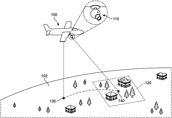
1. A method of decreasing the time required to assess structural damage using aerial imagery, the method comprising:
capturing an image of a geographic area including a known structure using a camera aboard an aerial vehicle;
sensing a first GPS position, an attitude, and an orientation for the aerial vehicle at a time when the image is taken;
determining a second GPS position for a reference location within the image, using the first GPS position, the attitude, and the orientation;
retrieving a third GPS position for the known structure;
identifying a structure location for the known structure within the image using the second GPS position and the third GPS position;
automatically cropping, based on the structure location, the image to produce a cropped image including the known structure; and
using a damage classification model to assess damage to the known structure in the cropped image.
|