| US 11,810,202 B1 | ||
| Method and system for identifying conditions of features represented in a virtual model | ||
| Rebecca A Little, Gilbert, AZ (US); Bryan R Nussbaum, Bloomington, IL (US); Deanna L Stockweather, Normal, IL (US); Nathan C Summers, Mesa, AZ (US); An Ho, Phoenix, AZ (US); and Vicki King, Bloomington, IL (US) | ||
| Assigned to State Farm Mutual Automobile Insurance Company, Bloomington, IL (US) | ||
| Filed by STATE FARM MUTUAL AUTOMOBILE INSURANCE COMPANY, Bloomington, IL (US) | ||
| Filed on Oct. 17, 2018, as Appl. No. 16/163,146. | ||
| Int. Cl. G06Q 40/08 (2012.01); G06T 17/05 (2011.01); G06F 16/29 (2019.01) | ||
| CPC G06Q 40/08 (2013.01) [G06F 16/29 (2019.01); G06T 17/05 (2013.01)] | 7 Claims |
|
1. A computer-implemented method comprising:
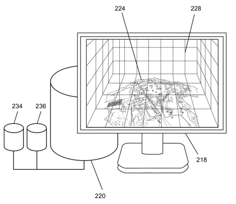
storing, by one or more processors, in a memory of a server, a model generation routine comprising feature condition rules, wherein the feature condition rules include templates data and a rule for comparing image data to the templates data according to a threshold; receiving, by the one or more processors, a data request from an electronic device of a user, wherein the data request comprises one or more properties of interest; executing, by the one or more processors, the model generation routine; generating, by the executing model generation routine, a first virtual model of the one or more properties of interest within a virtual environment based upon a plurality of images of the one or more properties of interest; displaying, by the executing model generation routine, on the electronic device of the user, the first virtual model of the one or more properties of interest within the virtual environment; receiving, by the one or more processors, an annotation at a virtual coordinate in the virtual environment of at least one feature of the one or more properties of interest from the electronic device of the user; translating, by the executing model generation routine, the virtual coordinate of the at least one feature of the one or more properties of interest from the first virtual model into Global Positioning System (GPS) coordinates of a location of the at least one feature of the one or more properties of interest; generating and transmitting, by the executing model generation routine, to a remote imaging vehicle, a notification comprising the GPS coordinates of the location of the at least one feature of the one or more properties of interest; capturing and sending, by the one or more processors via the remote imaging vehicle, at least one captured image from the location of the at least one feature of the one or more properties of interest; determining, by the executing model generation routine, and using the rule, that the at least one captured image of the at least one feature of the one or more properties of interest is above the threshold; generating, by the executing model generation routine, a second virtual model of the one or more properties of interest by updating the first virtual model with the at least one captured image of the at least one feature of the one or more properties of interest; and displaying, by the one or more processors, the second virtual model of the one or more properties of interest in the virtual environment on the electronic device of the user. |