| CPC B60W 60/0015 (2020.02) [B60W 30/09 (2013.01); B60W 30/0956 (2013.01); G01S 13/72 (2013.01); G01S 13/931 (2013.01); G08G 1/167 (2013.01); B60W 2420/52 (2013.01); B60W 2552/53 (2020.02)] | 19 Claims |

|
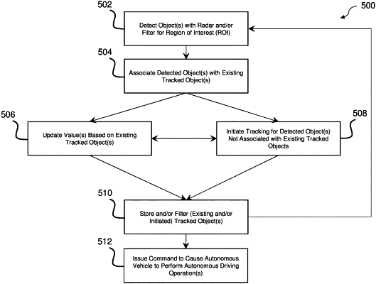
1. A method for resolving level ambiguity for radar systems of autonomous vehicles, comprising:
detecting, with at least one processor, a plurality of detected objects with a radar system of an autonomous vehicle;
associating, with the at least one processor, each first detected object of at least one first detected object of the plurality of detected objects with a respective existing tracked object of at least one existing tracked object based on a first position of each first detected object;
storing, with the at least one processor, first tracked object data based on a first height determined for each first detected object associated with each respective existing tracked object, the first height of each first detected object being determined by:
querying, with the at least one processor, a tile map based on the first position of the first detected object to provide a plurality of ground heights; and
determining, with the at least one processor, a first ground height of the plurality of ground heights closest to an existing height of the respective existing tracked object as the first height of the first detected object; and
issuing, with the at least one processor, a command to cause the autonomous vehicle to perform at least one autonomous driving operation, the command being based on the first-height of each first detected object.
|