| CPC G08G 5/065 (2013.01) [B64D 45/00 (2013.01); G05D 1/0202 (2013.01); G06F 18/251 (2023.01); G06T 7/521 (2017.01); G06V 20/13 (2022.01)] | 20 Claims |
|
1. A method for tracking an aircraft, comprising:
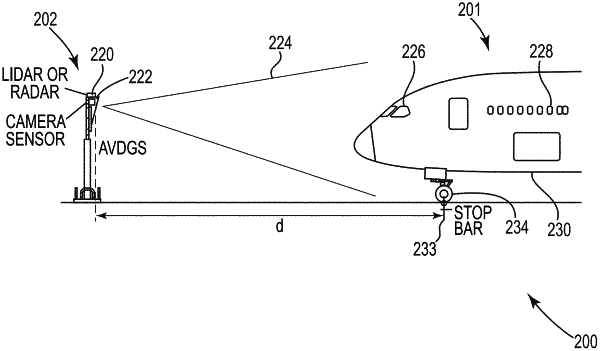
receiving camera image data of the aircraft while the aircraft is approaching or in a ramp area;
receiving LIDAR/Radar sensor data of the aircraft while the aircraft is approaching or in the ramp area;
merging the camera image data and the LIDAR/Radar sensor data into a merged data set;
wherein the LIDAR/Radar sensor data and camera image data of the merged data set are both used to form a three dimensional virtual model of at least a portion of the aircraft; and
displaying messages to provide directional and speed guidance to a pilot with the merged data set.
|