| CPC G06V 20/182 (2022.01) [G01C 11/04 (2013.01); G06V 10/30 (2022.01); G06V 10/42 (2022.01); G06V 10/44 (2022.01); G06V 10/56 (2022.01); G06V 10/751 (2022.01); G06V 30/422 (2022.01)] | 20 Claims |
|
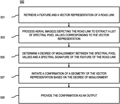
1. A method comprising:
retrieving a feature and a vector representation of a road link;
processing one or more aerial images depicting the road link to extract a list of spectral pixel values corresponding to the vector representation;
determining a degree of misalignment between the spectral pixel values and a spectral signature of the feature of the road link;
initiating a confirmation of a geometry of the vector representation based on the degree of misalignment; and
providing the confirmation as an output.
|