| CPC G01N 21/8851 (2013.01) [G01S 17/86 (2020.01); G01S 17/89 (2013.01); G06N 20/00 (2019.01); G06T 7/0002 (2013.01); G06T 17/00 (2013.01); G01N 2021/8887 (2013.01); G06T 2207/10028 (2013.01); G06T 2207/20084 (2013.01)] | 20 Claims |
|
1. A structure diagnosis system, comprising:
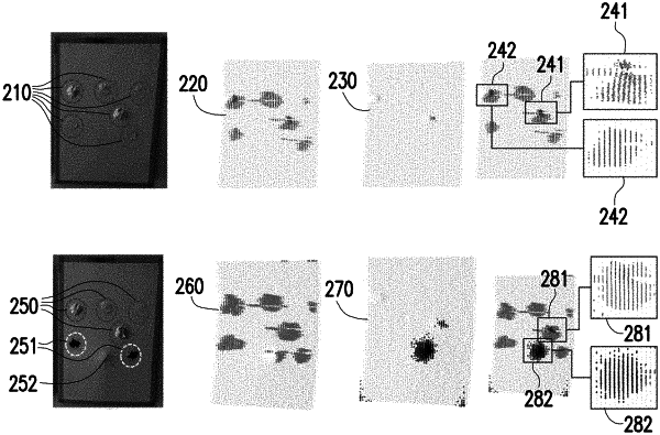
a lidar scanner, configured to scan a structure so as to generate a point cloud data;
an input interface, coupled to the lidar scanner and configured to receive the point cloud data; and
a processor, coupled to the input interface, configured to receive the point cloud data and generate a point cloud data set, wherein the processor executes a surface degradation and a geometry abnormal coupling diagnosis module so as to:
mark a first point cloud range of a surface degradation area according to a color space value of the point cloud data set;
mark a second point cloud range of a geometry abnormal area according to a coordinate value of the point cloud data set;
determine, when an abnormal area comprises at least partially overlapping area between the first point cloud range and the second point cloud range, that the surface degradation or the geometry abnormality occurs at the abnormal area, and mark the abnormal area with a predetermined mode.
|