| CPC G06T 17/05 (2013.01) [G06F 16/29 (2019.01); G06T 19/20 (2013.01)] | 20 Claims |
|
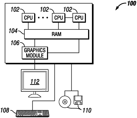
1. A method for creating a scalable geological model comprising:
identifying a plurality of geological scales;
establishing a geological tiered system;
identifying one or more graphical resolution levels for each geologic scale in the plurality of geological scales;
assimilating geological data from the plurality of geological scales to form a scalable geological model;
adding a well scale to the scalable geological model if a petrophysical property is present in a data set, wherein the petrophysical property is a continuous variable;
utilizing a point cloud method to handle one or more continuous variables;
utilizing a gridless point vector method to handle one or more categorical variables;
utilizing the scalable geological model to control and predict induced fracture propagation during a hydraulic fracturing operation; and
utilizing the scalable geological model to create one or more production forecasts.
|